
Moreton Bay Council Unveils Flood Mitigation Plan for 2027
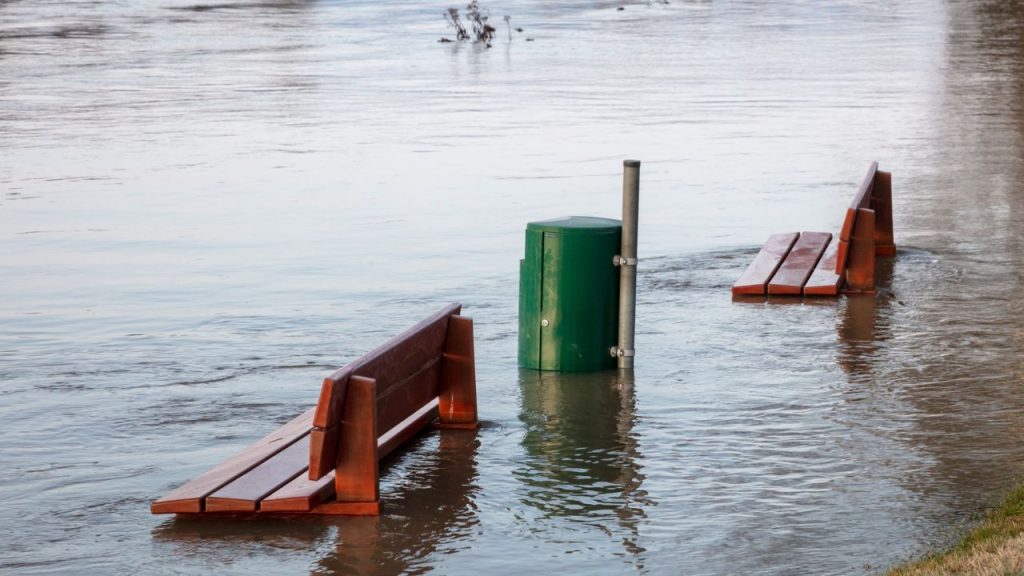
Kev Ransome has lived on the same street in Burpengary East for nineteen years, and he can tell you exactly how high the water got in 2022 without looking it up. “Halfway up the letterbox,” he said, standing in his driveway on a grey Tuesday morning. “Second time in a decade.” His neighbour across the road still has a tide mark on the brick fence, faded now but visible if you know where to look.
That kind of local memory is exactly what Moreton Bay Regional Council says it’s trying to get ahead of. On Monday, the council released the details of its Flood Mitigation Plan for 2027, a staged program aimed at the catchments that have flooded hardest and most often over the past fifteen years. Caboolture River, Burpengary Creek and the lower reaches of the Pine River all feature early in the rollout, which isn’t a surprise to anyone who’s lived through a wet season out that way.
The plan itself runs to several hundred pages, but the headline numbers are what residents are talking about at the moment. Council has confirmed a multi-year budget allocation, with the first tranche of works set to begin construction in early 2027. That includes upgraded stormwater infrastructure in several low-lying suburbs, a new detention basin near Burpengary East, and widened culverts along sections of Caboolture River Road that have been known to go under in heavy rain for years.
There’s also a softer side to the plan that doesn’t get as much attention as the concrete and steel. Council is proposing a revised flood mapping system, updated using more recent rainfall data and climate modelling than the maps currently in circulation. For a lot of homeowners, that’s the part that actually matters day to day. Flood overlays affect everything from insurance premiums to what you’re allowed to build, and plenty of locals have long argued the existing maps are out of date.
Tracy Allenby, who runs a small accounting business out of Morayfield, said she’s been waiting on exactly this kind of update. “We had clients getting insurance quotes that didn’t match what actually happens on their street,” she said. “If the new maps are more accurate, that’s going to change a few people’s premiums, for better or worse.” She’s not wrong to flag the “for worse” part. Updated mapping sometimes means properties previously considered low risk get reclassified, and that conversation hasn’t fully played out yet.
The timing of the announcement isn’t an accident either. Spring storm season has already shown signs of arriving early across South East Queensland this year, and the memory of the 2022 floods is still close enough to the surface that nobody needs reminding why this matters. Moreton Bay was one of the hardest hit local government areas in that event, with entire streets in Caboolture, Burpengary and parts of Deception Bay cut off for days. Council’s own figures at the time put the damage bill for roads and public infrastructure well into the tens of millions.
So what does the plan actually involve on the ground? Three things stand out. First, drainage upgrades in roughly a dozen identified flood hot spots, prioritised by how often and how badly they’ve flooded historically rather than by suburb size or property value, which is a point council has been keen to stress. Second, a staged buyback and voluntary house-raising scheme for a small number of properties sitting in the most repeatedly affected zones, something that’s been floated before but never formally funded until now. Third, an early warning system upgrade, tying local river gauges into a faster alert network that pushes notifications directly to residents’ phones rather than relying solely on radio and council social media.
Not everyone’s convinced it goes far enough. At a community information session held last week in Caboolture, a handful of residents pushed back on the timeline, arguing that staged works stretching out to 2029 and beyond leave people exposed through at least two more wet seasons before the bulk of the infrastructure is finished. One man, who didn’t want to give his name but has lived in the area since the 1990s, put it bluntly: “We’ve heard plans before. What we need is diggers on the ground.”
Council has acknowledged the frustration. A spokesperson confirmed that the staged approach is partly a budget reality and partly about sequencing works so that upstream fixes go in before downstream ones, which is standard practice in flood engineering even if it’s a hard sell to someone whose lounge room has gone underwater twice in ten years.
For residents wanting the practical detail, council has set up a dedicated page where you can check whether your street falls within one of the priority catchments, see indicative timing for works near you, and register for the new alert system once it goes live. There’s also a series of community drop-in sessions planned across January and February, giving people a chance to ask questions directly before the first stage of construction kicks off.
Whether the plan delivers on its promises will take a few wet seasons to prove out properly. Infrastructure like this tends to be judged not by the announcement but by what happens the next time a king tide lines up with a week of heavy rain. For now, though, there’s cautious relief among residents like Kev, who said he’d rather see something move than nothing at all. “I’m not holding my breath,” he said, glancing at that fence line across the road. “But at least they’re talking about the right streets this time.”